-40%
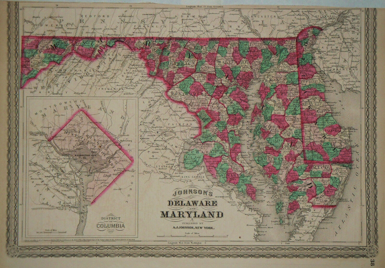
1870 Genuine Antique Hand Colored Map Delaware & Maryland, Dist of Col. Johnson
$ 13.2
- Description
- Size Guide
Description
Genuine Antique map "Johnson's Delaware & Maryland" fromJohnson's Family Atlas of the World
published by A. J. Johnson, New York, 1870. Bright hand coloring on this map delineates counties in the states of Delaware and Maryland with lakes, waterways, roads, mountains and coastline with barrier islands shown in nice detail. Many cities are named. Inset shows District of Columbia. Attractive image is surrounded by an elegant border on three sides. Top border has been trimmed. Good condition with only slight age toning. Image measures 11 1/2" x 17".
THIS IS NOT A REPRODUCTION! All of our items are genuine antiques as described.
