-40%
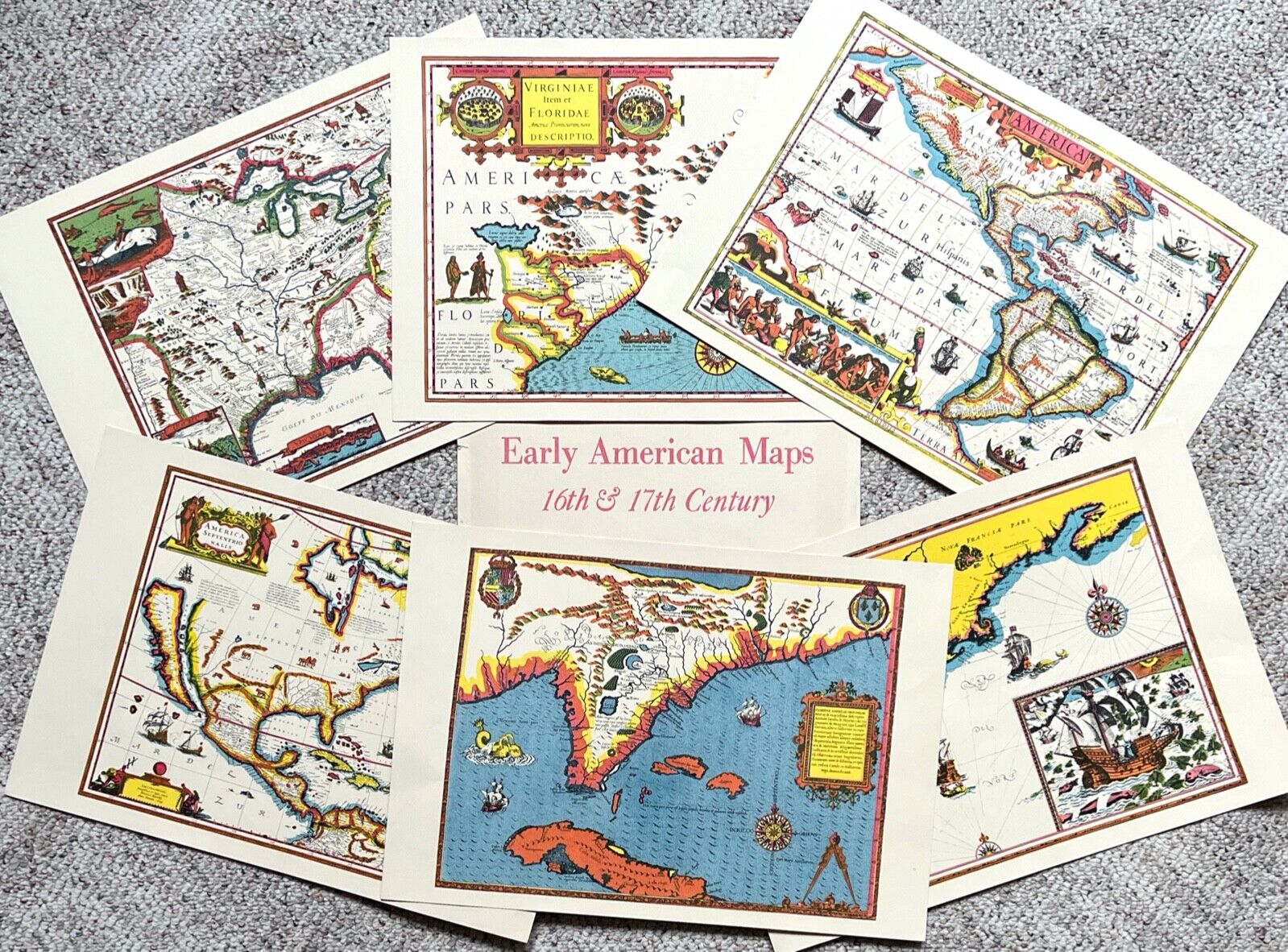
6 Early American Maps Of 16th & 17th Centuries By Frederick's Fine Art 19 x 13.5
$ 7.91
- Description
- Size Guide
Description
Set of 6 Early American Maps by Frederick's Fine ArtFull color reproductions suitable for framing
Each map is 19" x 13-1/2"
Photo 1
- Carte de Canada et de la Louisiane 1695
Photo 2
- Virginiae et Florida 1606
Photo 3
- Septentrio America 1597
Photo 4
- America Septentrio Nalis 1629
Photo 5
- Floridaw Americae Provinciae 1592
Photo 6
- Nova Anglia Novvam Belgium et Virginia 1637
These have been kept in the protective folder and are ready for framing
Will ship flat
