-40%
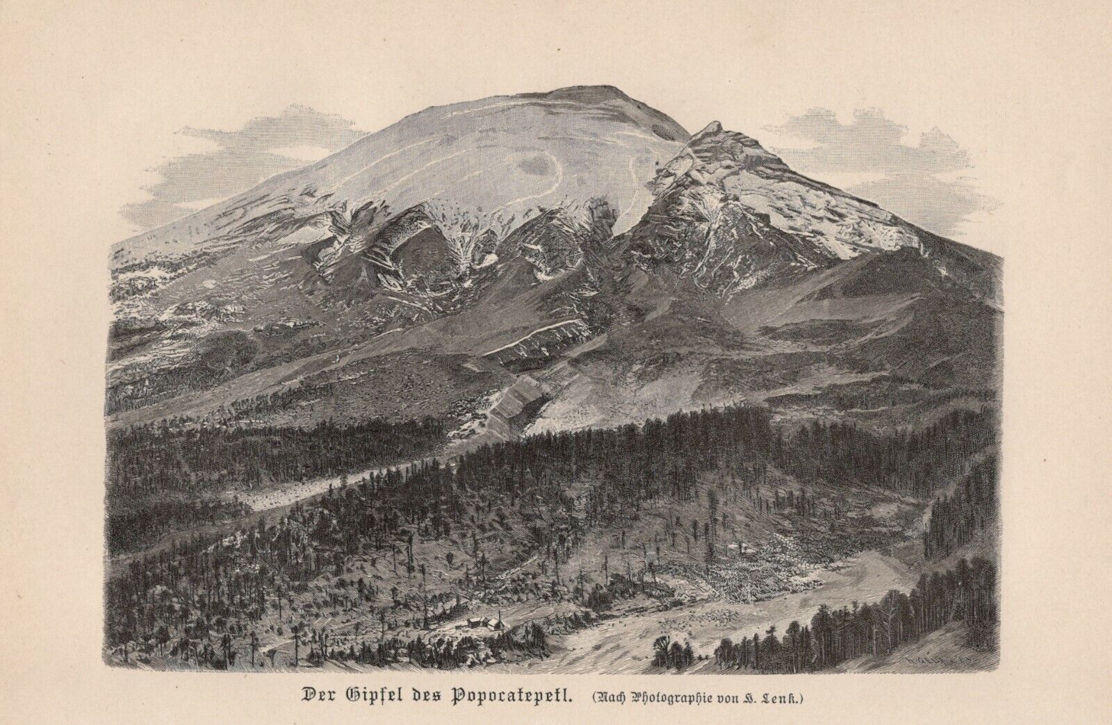
Popocatépetl Volcano Mexico The Popo Don Goyo Wood Engraving From 1895
$ 4.3
- Description
- Size Guide
Description
The peak of PopocatépetlOriginal WOOD ENGRAVING from 1895 (no reprint - no copy)
Sheet size approx. 24.5x16cm.
Condition: good - see scan.
Shipping is of course quick and safely packaged!
Shipping:
Here are more motifs in the shop!
I offer many other maps, lithographs and engravings on the subject of astronomy - shipping costs only apply once for multiple items purchased!
Documentation for the item:
Popocatépetl (Smoking Mountain), sometimes called El Popo or Don Goyo, is a volcano on the edge of the highlands of Mexico. It is considered one of the most active volcanoes in Mexico. Depending on the source, its current height is up to 5452 m. This makes it the second highest volcano in North America after the Citlaltépetl (5636 m, also known as Pico de Orizaba) and the second highest mountain in Mexico. The Popocatépetl is located between Mexico City and Puebla and is connected to the sister volcano Iztaccíhuatl (5286 m) via the Paso de Cortés, which lies north of the Popocatépetl. Geographically, the mountain peak is on the border of the Mexican states of Morelos, Estado de México and Puebla. The volcano is part of the Sierra Volcánica Transversal, which runs through the country from west to east. At 5452 meters it is also one of the highest exponents of this mountain range. The Popocatépetl is a stratovolcano partially covered by glaciers. The volcanic cone rests on the remains of at least three predecessors that were destroyed by gravitational collapse. Significant debris flow deposits bear witness to these events. The current central crater has a diameter of 400 to 600 m and is partly filled by lava domes. The conical shape of the mountain is broken by the so-called "Ventorillo", the remnant of a former volcano. Pópocatépetl itself has produced at least three Plinian eruptions since the middle Holocene, followed by pyroclastic flows and lahars. Its rocks are influenced by the southern subduction zone and range from basalt to dacite, although with a bias toward the more evolved, ie, more siliceous, rock types and magma mixing. The materials originating from a near-surface magma chamber are relatively homogeneous and contain both felsic and mafic components. The volcanic system also includes the currently dormant neighboring volcano Iztaccíhuatl, although activity has shifted southward from the latter to the former over hundreds of thousands of years. Until 2001, the Popocatépetl was covered with visible glaciers, especially on the northern flank. However, these decreased significantly from the 1990s due to warmer temperatures and increased volcanic activity. Since then, only partial ice can be found on the mountain, but it no longer has the characteristic properties of glaciation (Glacier crevasses, etc.) Due to the close proximity to large Mexican centers, it is only around 70 km to Mexico City and around 40 km to Puebla. Tlaxcala is approximately 50 kilometers northeast and Ciudad Nezahualcoyotl approximately 60 kilometers northwest of the volcano. The volcano is prominently visible from Allen locations under appropriate weather conditions. It is estimated that around 25 million people live in its catchment area, ie within a radius of 100 kilometers around the volcano. The closest town to the volcano is San Pedro Nexapa (about 4,600 inhabitants), which is 13 kilometers north-west and is therefore just outside the exclusion zone.
(Source: Wikipedia)
If combined shipping via eBay doesn't work, I will of course refund the overpaid shipping costs!
Popocatépetl (Smoking Mountain), sometimes called El Popo or Don Goyo, is a volcano on the edge of the highlands of Mexico. It is considered one of the most active volcanoes in Mexico. Depending on the source, its current height is up to 5452 m. This makes it the second highest volcano in North America after the Citlaltépetl (5636 m, also known as Pico de Orizaba) and the second highest mountain in Mexico. The Popocatépetl is located between Mexico City and Puebla and is connected to the sister volcano Iztaccíhuatl (5286 m) via the Paso de Cortés, which lies north of the Popocatépetl. Geographically, the mountain peak is on the border of the Mexican states of Morelos, Estado de México and Puebla. The volcano is part of the Sierra Volcánica Transversal, which runs through the country from
