-40%
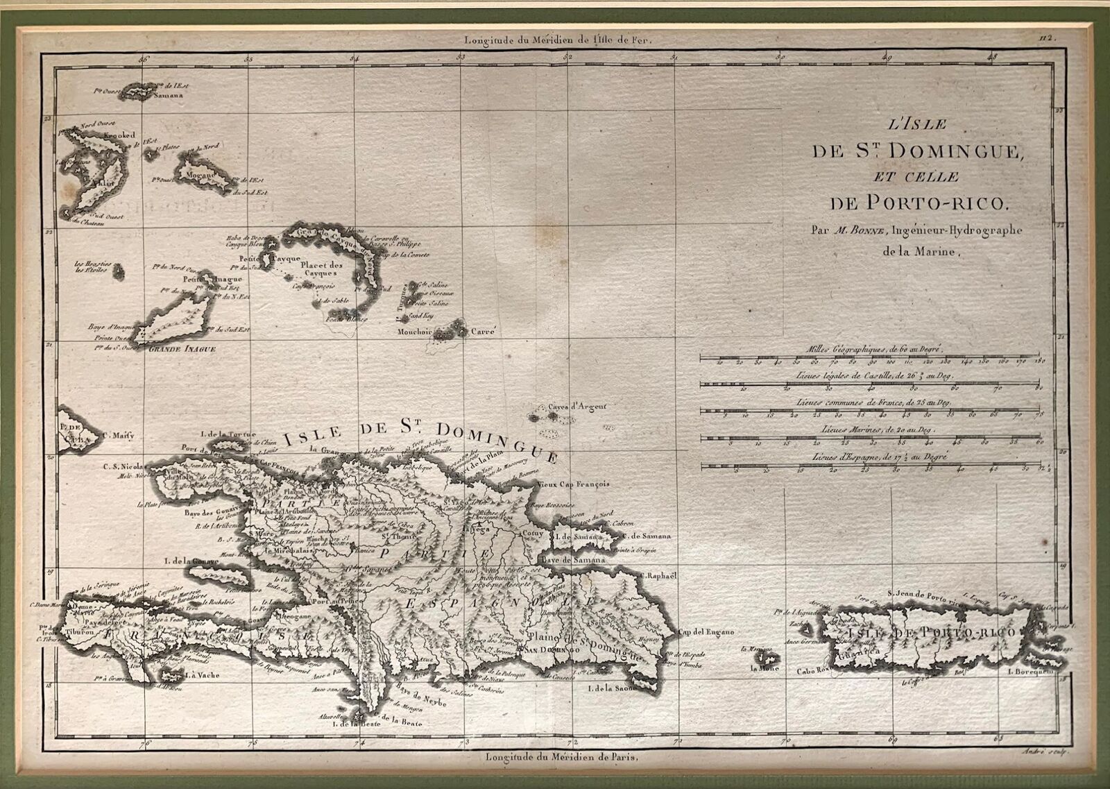
Rigobert Bonne / Isle de St Domingue et celle de Porto-Rico 1787
$ 94.51
- Description
- Size Guide
Description
Isle de St. Domingue et celle de Porto-RicoAuthor:
Bonne, Rigobert
Title:
Isle de St. Domingue et celle de Porto-Rico
Publication:
1787
Description:
Isle de St. Domingue et celle de Porto-Rico, Rigobert Bonne, 1787, 11.25 x 16.125 inches.
Fine Condition. Light foxing. Mounted at top edge with archival tape to mat board. Vertical fold at middle. Not colored. Will ship with matting. Watermark difficult to discern.
Detailed map of Santa Domingo, Puerto Rico, and nearby islands. Includes topographical detail with many place names. Includes Eastern Bahamas. Extracted from Bonne's Atlas Supplement which was published in Paris in 1787. Rigobert Bonne (1727-1794) was an influential French cartographer of the late-eighteenth century.
Seller ID:
782
Subject:
Maps
Stellar Books & Ephemera
is an on-line antiquarian dealer offering a wide variety of unique, unusual and rare artifacts of American History ranging from letters, manuscripts, archives and diaries to 19th century photography and 20th century letterpress. We specialize in the ephemeral and occasionally offer finer books which strike our fancy. If we stock it, you know it's unique.
Terms
All items are guaranteed to be as described or they may be returned within 30 days of receipt.
This listing was created by Bibliopolis.
