-40%
Samoa Maouna Island Polynesia Pacific Ocean Map Card Perouse Copperplate 1797
$ 42.64
- Description
- Size Guide
Description
Samoa Maouna Island Polynesia Pacific Ocean Map Card Perouse Copperplate 1797The description of this item has been automatically translated. If you have any questions, please feel free to contact us.
Many more old maps, graphics and antiquarian books in our eBay shop!
We also buy!
Jean-François de Galaup de La Pérouse:
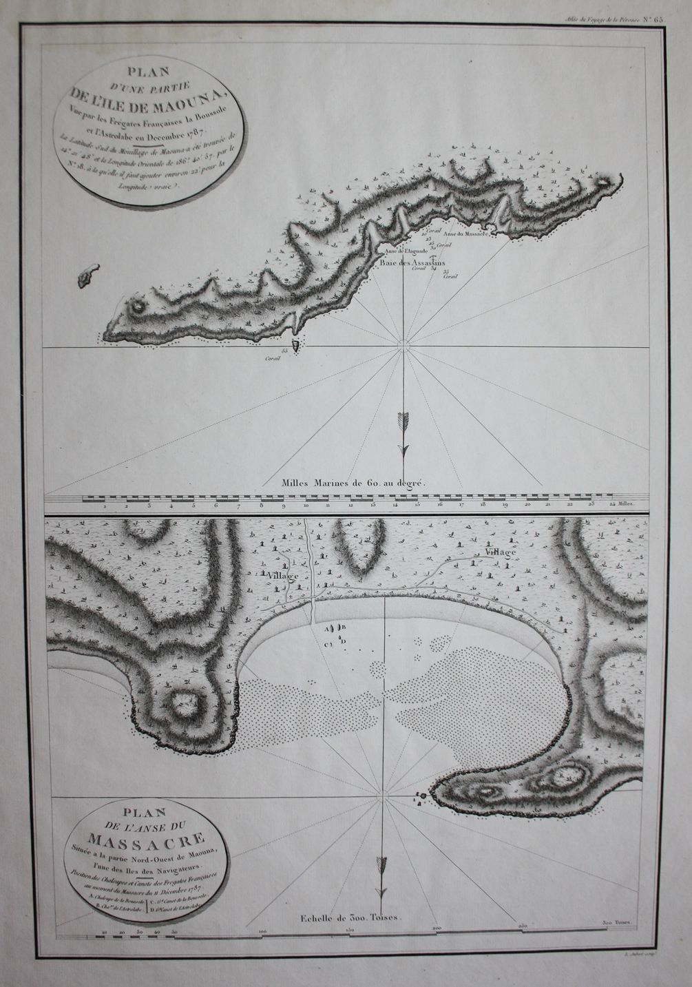
"Plan of a section of the island of Maouna, seen from the French frigates the Boussole and the Astrolabe in December 1787. / Map of the Anse du Massacre located in the north-west part of Maouna, one of the Navigators' Islands." - Samoa Maouna island Polynesia Pacific Ocean Atlas of the Perouse Voyage
Paris 1797.
Large format original copper engraving. -- -- Sheet dimensions: approx. 58x42cm. -- slightly brown-stained at the upper edge, otherwise in good condition. Large format original copper engraving. -- -- The lower map shows the coast where Paul Antoine Fleuriot de Langle (1744-1787) was murdered by natives. -- slightly brownstained on the upper margin, otherwise in good condition. Jean-François de Galaup de La Pérouse (1741 1788) was a French sailor, circumnavigator and geographer in the Age of Enlightenment. From 1772 to 1776, La Pérouse sailed on behalf of the French governor in the Indian Ocean between the French-controlled colonies of Mauritius, Réunion, Pondicherry in southern India and Madagascar and later also to Australia. In February 1788, La Pérouse sent a message home with the planned route: via Tonga, New Caledonia and the Solomon Islands to New Guinea. But La Pérouse achieved none of these goals. Both ships and their crew disappeared without a trace. It is believed that the ships got caught in a tropical cyclone. Jean-François de Galaup de La Pérouse (1741-1788) was a French navigator, circumnavigator and geographer in the Age of Enlightenment. From 1772 to 1776, La Pérouse sailed on behalf of the French governor in the Indian Ocean between the French-controlled colonies of Mauritius, Reunion, Pondicherry in southern India and Madagascar and later also to Australia. In February 1788, La Pérouse sent a message with the further planned route home: via Tonga, New Caledonia and the Solomon Islands it was to go to New Guinea. But La Pérouse did not achieve any of these goals. Both ships and crew disappeared without a trace. The ships are believed to have been hit by a tropical cyclone. This engraving comes from the very rare atlas Atlas du Voyage de la Perouse. printed in Paris in 1797.
Order number: 191801
Many more antique maps and prints on our site antiquariat-voelkel.
Many more old maps, views and graphics on our own page antiquariat-voelkel.
Illustrations
Recorded with whBOOK
Secure ordering - Order Control tested!
Item listed with the w+h GmbH eBay service
Data and images powered by
Book lover
(2024-07-14)
Paris 1797. Large format original copper engraving. -- -- Sheet dimensions: approx. 58x42cm. -- slightly brown-stained at the upper edge, otherwise in good condition. Large format original copper engraving. -- -- The lower map shows the coast where Paul Antoine Fleuriot de Langle (1744-1787) was murdered by natives. -- slightly brownstained on the upper margin, otherwise in good condition. Jean-François de Galaup de La Pérouse (1741 1788) was a French sailor, circumnavigator and geographer in the Age of Enlightenment. From 1772 to 1776, La Pérouse sailed on behalf of the French governor in the Indian Ocean between the French-controlled colonies of Mauritius, Réunion, Pondicherry in southern India and Madagascar and later also to Australia. In February 1788, La Pérouse sent a message home
Originalität
Unikat Handgefertigt Original
Drucktyp
Handgefertigt
