-40%
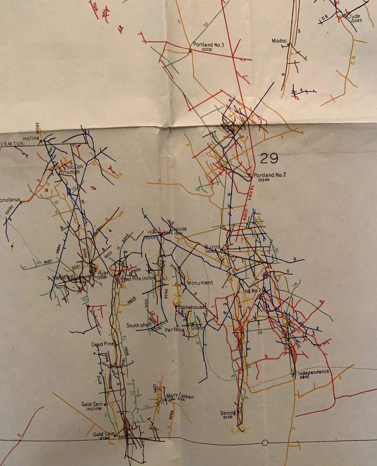
Waldemar Lindgren / Plan of Principal Underground Workings at Cripple Creek
$ 46.99
- Description
- Size Guide
Description
Plan of Principal Underground Workings at Cripple Creek, Colorado--Compiled from the Mine Maps of the Various CompaniesAuthor:
Lindgren, Waldemar and F.L. Ransome
Title:
Plan of Principal Underground Workings at Cripple Creek, Colorado--Compiled from the Mine Maps of the Various Companies
Publication:
United States Geological Survey, 1905
Description:
J.L. Bruce. Plan of Principal Underground Workings at Cripple Creek, Colorado--Compiled from the Mine Maps of the Various Companies, United States Geological Survey Professional Paper No. 54 Plate III.
Folding map measures 52.5 x 31.75 inches. Light chipping to edges; some separation at folds with clear tape to the separations. Very Good Condition.
Large colorful map of the underground workings at Cripple Creek, Colorado from 1905 as compiled from various mining maps of the various companies active at Cripple Creek. Published in 1905 in United States Geological Survey Professional Paper No. 54. Plate III.
Cripple Creek was the locale for the last great Colorado gold rush when gold was discovered in 1890. By 1900, the Cripple Creek mining district was home to almost 500 mines and multiple lawsuits of competing claims. A quick look at this map shows the many competing tunnels of the competing companies. By 1910, the region had produced 22.4 million ounces of gold.
Seller ID:
1319
Subject:
Maps, Western Americana
Stellar Books & Ephemera
is an on-line antiquarian dealer offering a wide variety of unique, unusual and rare artifacts of American History ranging from letters, manuscripts, archives and diaries to 19th century photography and 20th century letterpress. We specialize in the ephemeral and occasionally offer finer books which strike our fancy. If we stock it, you know it's unique.
Terms
All items are guaranteed to be as described or they may be returned within 30 days of receipt.
This listing was created by Bibliopolis.
